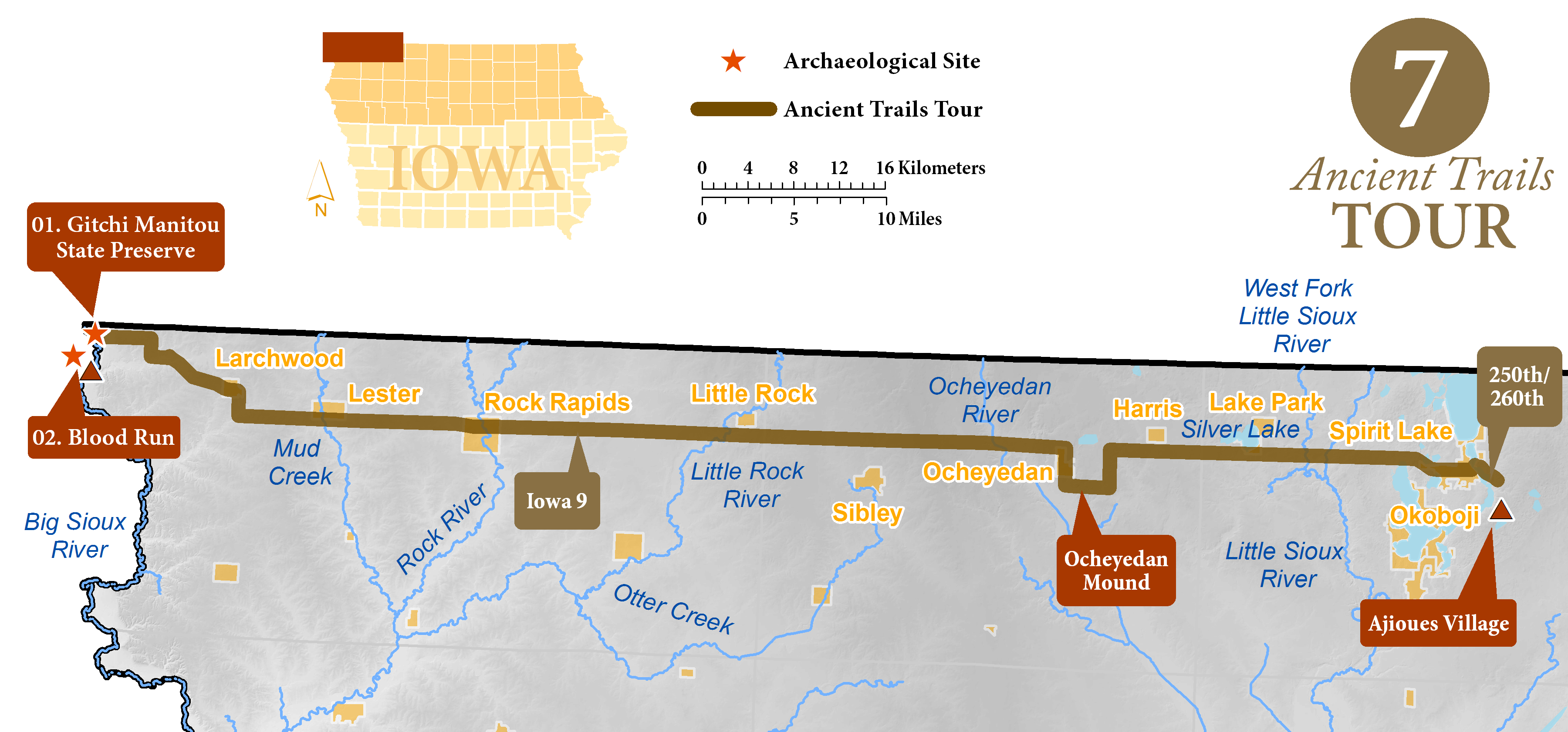
Spirit Lake to Blood Run Tour
Spirit Lake to Gitchi Manitou (85 miles)
The Chemin des Voyageurs extended from the Ioway and Otoe villages along the Spirit Lakes west to the largest village complex in the state. Early explorer maps show this segment of the Chemin as a straight line, and no route is straighter than Highway 9. It is fair to assume that overland travelers would have stopped off at the natural lakes that line the way, including Silver Lake and Rush Lake, these two lakes are shown conspicuously on early maps of Iowa, suggesting they were important to early travelers. Silver Lake was called “Ptanska.” As the road moves from the swampy Des Moines Lobe to the Northwest Iowa Plateau near Sibley, natural lakes disappear and rolling prairie hills begin. The Little Rock and Rock rivers would provide some relief from the exposed upland trails. Take a detour to see Ocheyedan Mound, a natural hill that was a landmark to American settlers.
After Larchwood, take a left on 120th Street, a right on Ashley Avenue, and a left on 110th. Follow 110th to Gitchie Manitou State Preserve, in the farthest northwest corner of Iowa. Gitchie Manitou has several low Indian mounds (Archaeological Guide to Iowa 1) and is the northern-most component of the Blood Run complex (Archaeological Guide to Iowa 2). Blood Run, also called Good Earth, was the largest Indian settlement in the region in the 1700s, where numerous tribes met, including Omaha, Ponca, Ioway, and Otoe. This was the end of the line of the Chemin des Voyageurs, where furs transported by river from the Plains were gathered to be shipped east overland to the Great Lakes and Europe.
Archaeological Sites
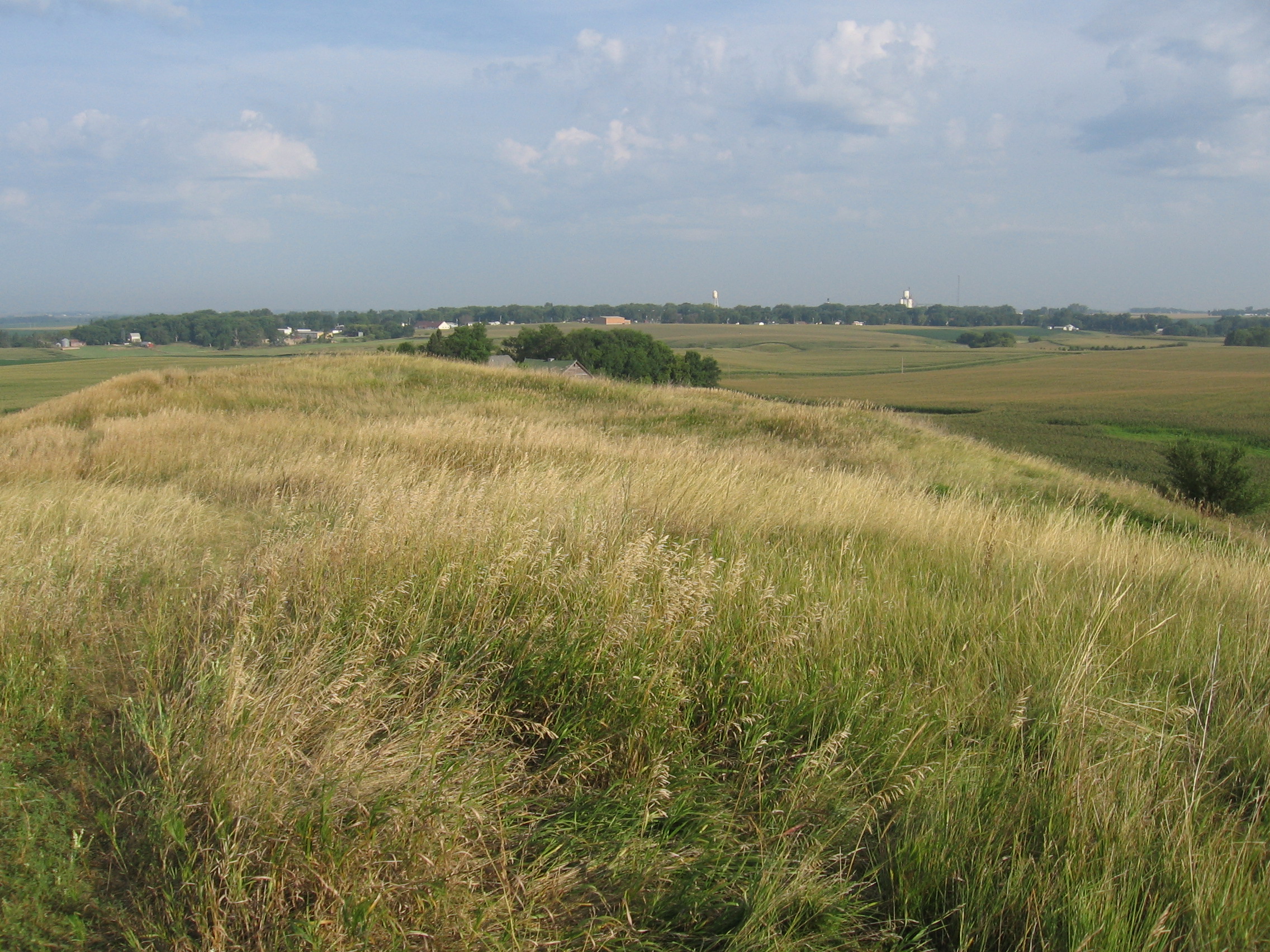
01. Gitchi Manitou State Preserve
Located in far northwest Iowa, Gitchie Manitou, Ojibwa for "great spirit," is a complex of mounds. Home to the oldest bedrock in Iowa, the Sioux quartzite bedrock here was laid down around 1.6 billion years ago, at the time when unicellular organisms began to evolve into multicellular life.
The low mounds of Gitchie Manitou saw long-running debates over their authenticity. Some locals asserted the Works Progress Administration (WPA) bolstered or even constructed the mounds during the 1930s. Only in 2013, through a comparison of soil layering, were the mounds conclusively proven to be of historical provenance, over one thousand years old.
The state of Iowa initially purchased Gitchie Manitou as a quarry, but the WPA transformed the site into a park in the 1930s. In 1969, Gitchie Manitou was named a state preserve. The mounds of Gitchie Manitou have never been excavated, as they may contain human remains.
02. Blood Run/Rock Island- A National Historic Landmark without Equal
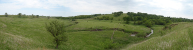
Blood Run, named for a creek which transects the property, was first occupied 6500 years ago, and probably earlier. It reached its zenith as a Midwest trading center in the 1500s and 1600s, with artifacts from the Ioway, Otoe, Arikara, Cheyenne, and Dakota cultures all present. European trade items reached the Blood Run site prior to the actual arrival of Europeans. When Europeans moved into the area in the early 1700s, though, the site was all but abandoned; the Dakota peoples ceded this portion of land to American settlers in 1851. 
Nineteenth-century observers recount a fifteen-acre oval embankment and a serpent shaped mound, now both vanished. Current researchers find no historical evidence of either. Today, visitors to Blood Run can witness earthen burial mounds, stone circles, and large pitted boulders. Plowing, a railroad track, quarrying, and digging have taken the toll on the site, which nonetheless is powerfully evocative of the past.
The site was marked as a National Historic Landmark in 1970, and, in 1987, the State Historical Society and the Iowa National Heritage Foundation acquired the property.
Descendant peoples, local communities, and preservation organizations work together to understand and protect Blood Run.
To Visit
Blood Run is located in Iowa and South Dakota along the Big Sioux River and Blood Run Creek. South Dakota is developing the Good Earth State Park at Blood Run and the Iowa Department of Natural Resources is working on a study to develop a companion park in Iowa.
A visitor center is located 1 mile south of 1001 120th Street, Larchwood, Iowa. Grounds are open from sunrise to sunset. A self-guided walking tour is available here.