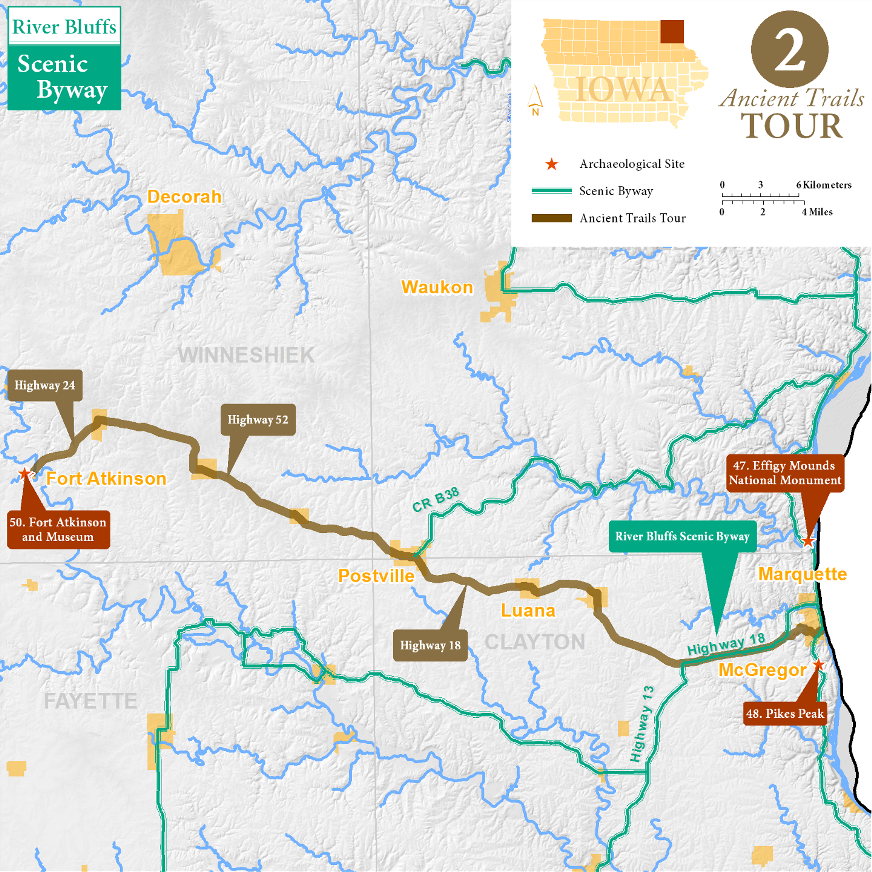
McGregor to Fort Atkinson Tour
The overland route west from McGregor is arguably the oldest trail mapped in Iowa. It was part of the Chemin des Voyageurs, a cross-country route which connected large Ioway, Omaha, and Otoe villages in western Iowa with the Wisconsin River fur trade route to the Great Lakes and ultimately Europe. Parts of this route later served as the main supply route for the U.S. Army in Iowa, connecting Fort Crawford in Prairie du Chien with Fort Atkinson.
From the Mississippi Through McGregor (2 miles)
The long valley out of the Mississippi bottom which runs through McGregor was the easiest way to access the interior of Iowa from the mouth of the Wisconsin River, making it the starting point of the Chemin des Voyageurs. The valley was called Coulee de Sioux in the early 1800s.
Although Marquette was opposite Fort Crawford in Prairie du Chien this river crossing to Iowa was blocked by large slough islands. A clear path across the river extended from southern Prairie du Chien to McGregor. By 1850 a commercial ferry plied this route, bringing American immigrants to northern Iowa. The original route did not follow U.S. Highway 18 out of town, rather it likely followed the Center Street valley up to Eagle Drive on the ridge northwest of town. The overland route to Fort Crawford was known as the Military Road.
McGregor to Monona (11 miles)
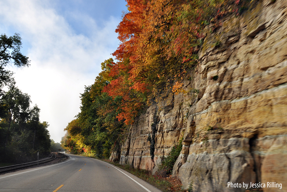
West of McGregor the Chemin likely followed the same route as modern U.S. 18 to Monona. This was part of a trail system that connected Dubuque to Decorah and St. Paul, and was well known to early settlers as an Indian trail. These upland trails would have been fast — comparatively straight with few obstacles, but travelers would have been exposed to the elements and enemies, and away from the water and game found in the valleys.
Monona to Postville (10 miles)
Follow W. Franklin St./115th Street west and you will be on the exact route taken by the Military Road. A fork in the GLO trails occurs in Luana, now a tiny hamlet, but once a major stopping point, with two hotels in the mid 1800s. Luana was also home to two nefarious whiskey holes called Sodom and Gomorrah, serving both soldiers and Indians, before the Army shut them down in the 1840s. At the crossroads, one trail headed north towards Decorah and ultimately St. Paul, the other west towards Fort Atkinson.
Postville was the site of the Army’s Half-Way House, where troops marching between Forts Atkinson and Crawford could rest and camp. It was run by Joel Post, the town founder.
Postville to Fort Atkinson (23 miles)
Several small towns emerged along the old Military Road, now followed by U.S. 52 and rail lines: Castalia, Ossian, and Calmar. All maintain a true small railroad town feel. A fun fact is that Ossian is pronounced “osh-in” by locals. Highway 24 leads to Fort Atkinson, a town that grew up below the imposing fort built in 1840. The Army built Fort Atkinson to protect and watch the Ho-Chunk who were forcibly removed from Wisconsin and lived in villages in southeast Minnesota and northeast Iowa. The fort grounds are open to the public, and a highly informative museum is nearby (50 and 51 in the Archaeological Guide to Iowa). Every autumn a large rendezvous of costumed fur traders camps around the picturesque ruins of the old fort.
River Bluffs Scenic Byway
This Ancient Trails Tour includes a portion of the River Bluffs Scenic Byway. Click here for more about the byway.
Archaeological Sites
47. Effigy Mounds National Monument
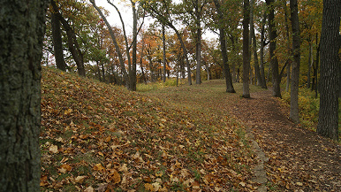
When soldiers from Fort Crawford (1816–1831) in Prairie du Chien led patrols into the interior of what is now Iowa, they crossed the Mississippi River on skiffs and marched up a steep valley to the top of the bluff. This military trail heading inland led them along a line of earthen mounds that seemed to shaped like animals, including ten bears and three birds.
The Marching Bears are the best known feature of Effigy Mounds National Monument, but they are only a small part of Iowa's premier archaeological destination. Founded in 1949 after nearly 50 years of lobbying, Effigy Mounds includes more than 200 prehistoric mounds.
To Visit
At this time there is no easy way to walk to the south unit from the visitor center; there is parking along State Highway 76, south of the Yellow River, and a trail entrance across the road. The Marching Bears are at the very end of the trail, about 2.5 miles south of the entrance. All trails are well maintained and marked, but hiking boots are recommended because the bluff trails can be steep.
48. Pike's Peak
50–51. Fort Atkinson and Museum
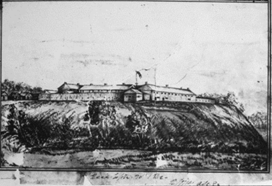 The abandoned fort is the only place in Iowa that a frontier fort with original buildings still stands in its original location. The grounds are surrounded by a stockade, rebuilt in 2006, but most of the buildings at the site are original, including the north barracks, the southwest blockhouse, and the powder house. The foundations of most other fort buildings are exposed on the ground surface.
In 1840, Fort Atkinson was built near the center of the Neutral Zone in an effort to keep the peace, to force the Ho-Chunk to stay in Iowa, and to keep U.S. settlers at bay until the area could be formally opened for settlement. Situated on a bluff of Roberts Creek, the fort was lonely, marked by soldiers deserting, drinking, and fighting. Horseback dragoon soldiers patrolled northern Iowa, attempting to enforce an impossible policy. In 1849, the Army removed the Ho-Chunk.
To Visit
Historic Fort Atkinson is an Iowa state preserve and is listed on the National Register of Historic Places as a Historic District. It is located at 303 2nd Street NW, Fort Atkinson. Just follow the signs. The grounds are open during the daylight, and admission is free. The fort has a museum, located in the north barracks, with artifacts and dioramas.