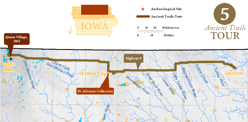
Decorah to Spirit Lake Tour
The Chemin Des Voyageurs is the oldest named road in Iowa, appearing on maps in the first decade of the 1700s. This trading highway connected the western Plains with the Wisconsin River fur trade route, shipping Indian-trapped pelts to the Great Lakes and ultimately Europe. The first-mapped Chemin trail began at the headwaters of the Upper Iowa and extended west towards Ioway and Otoe villages near Spirit Lake. Ancient Trails Tour 5 approximates this route.
Decorah to Cresco (20 miles)
The Decorah area was populated by Ho-Chunk (Winnebago) Indians before Euro-American settlers arrived. The Ho-Chunk were forced into Iowa beginning in the 1830s, and were largely removed from the state by 1849, although many continued to visit after this date.
Alonzo Bradish, who came to Decorah in 1852, described the early trails around town, including the marks left by ponies dragging "teepee poles". Another settler recalled,
[The Indians] had evidently intended to return at some future time as they had made large cellar-like holes in the ground in which were deposited all kinds of goods covered with the bark of trees. Such things as corn, feathers, axes, and kettles were in good preservation when exhumed by the new settlers.
Although the exact route of the Chemin des Voyageurs will probably never be known, the GLO mapped several ancient trails in Decorah and heading west that approximate the Chemin. Water Street to College Drive to Pole Line Road will take you through Decorah, along the beautiful Upper Iowa River bottoms, and ascend to the uplands. From there you will travel quickly to Cresco on Highway 9.
Cresco to Forest City (80 miles)
Most of Cresco’s streets are at an odd angle, because the town was laid out parallel to the railroad, which followed an old GLO trail. From Cresco head due west on 2nd Avenue/Highway 9. The meandering GLO trails which may have followed the old Chemin trail actually ran farther north, near the Minnesota border, but there are few clear remnants left of these old trails to follow. Highway 9 gives a good sample of the landscape the Chemin crossed, from the steep Driftless area to the rolling hills of the Iowan Surface, to the drained wetlands of the Des Moines Lobe. Historically, this area was occupied by Dakota Indians, who often fought against the Ho-Chunk and Sauk. You will pass through Riceville, Osage, Manly, Hanlontown, and Fertile. In 1854 a huge encampment of 500 Dakota camped near Fertile. Before you arrive at Forest City, take a detour to Pilot Knob, a prominent landmark for American settlers as they headed west.
Forest City to Spirit Lake (80 miles)
Winnebago Creek and Winnebago County were named for the Ho-Chunk, who had a large village near Clear Lake that was attacked by Dakota in 1854. Head north on Highway 9 in Forest City. Forest City is another town where the streets align with the railroad, rather than the cardinal directions. Follow Highway 9 west through Thomson, Buffalo Center, Lakota, Swea City, Armstrong, Estherville, and Superior before arriving at Spirit Lake. This long overland route was noted as treacherous to early explorers and settlers, who had to make their way through swampy land along barely visible trails. The route from Armstrong to Spirit Lake parallels an old trail noted by Lewis and Clark, who learned of it second hand while visiting an Omaha village along the Missouri River.
Archaeological Sites
29. Johnson Collection
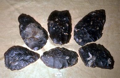
When archaeologists began systemically recording the location of archaeological sites, they noted a gap in north-central Iowa. This area of the Des Moines Lobe, the last area covered by glaciation in Iowa, was considered inhospitable by settlers due to the area's wetlands.
In the late 1970s, archaeologist Stephen Lensink led a project to address this deficiency. After interviews and fieldwork, he concluded that sites were abundant, but had not been recorded because of the area's comparatively low population and the lack of archaeological survey.
Helping Lensink with his work was the collection of Arlo Johnson, a local farmer, with its holdings of artifacts. Johnson had taken great care to record the sites where the artifacts were found and recorded the artifacts using the Smithsonian's Trinomial system.
To Visit
The Arlo Johnson collection is available for public viewing at the Timberlake Museum in Heritage Park on the south edge of Forest City, on U.S. Highway 69. Rice Lake State Park near Lake Mills is a good example of a northern Iowa lake with several prehistoric sites nearby. Take I-35 to exit 214, head west on Highway 105, and follow the signs to Rice Lake